The County
Walks Near Alnwick
Hulne Park behind the town, Iron Age hillforts in the Cheviots, the Northumberland Coast Path and St Oswald's Way: walking country within easy reach.
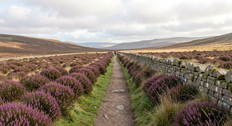
Walking around Alnwick scales from an hour's parkland stroll to days on a long distance path. The town sits between the managed parkland of the castle demesne, the open moors and hillforts of the Cheviots and the engineered path that runs the length of the coast, so the difficulty is choosing rather than finding.
Hulne Park: the town's own walk
Hulne Park is the walled demesne of the Duke of Northumberland lying immediately behind the town, open to walkers free of charge within daylight hours. Its drives and paths run through parkland and woodland past the ruins of Hulne Priory, a Carmelite friary founded in 1240 and among the best preserved of its order in England. The park allows no dogs and no cars, which keeps it quiet, and the gate at the town end puts a serious country walk literally steps from a bed in the centre, the kind of access the staying in town guide counts as a real advantage.
The Cheviots: hillforts and moor
West of Alnwick the land rises into the Cheviot hills, rounded moorland tops crossed by ancient routes. The range is studded with Iron Age hillforts, visible still as rings of ramparts on the summits, and offers everything from short valley walks to the summit of The Cheviot itself at 815 metres. Weather changes fast on the tops even in summer, so the same rules as any British upland apply: map, waterproofs and honest turnaround times. Local walking guides, including routes written by working shepherds in the area, catalogue the options by grade.
The Northumberland Coast Path
The Northumberland Coast Path runs roughly sixty miles from Cresswell at the south end of Druridge Bay to Berwick upon Tweed, threading the beaches, castles and villages that the coast guide describes. From Alnwick the natural day sections are Alnmouth to Craster and Dunstanburgh, and Craster to Seahouses, each around six to eight miles of mostly flat walking with the sea for company. The path suits walkers who want distance without navigation drama.
St Oswald's Way: the long line
St Oswald's Way is the county's other long path: ninety seven miles from Holy Island in the north, along the coast to Warkworth, then inland across country to end at Hadrian's Wall. Alnwick sits close to its coastal section, so sections around Warkworth and Alnmouth double as local day walks for visitors who will never do the full traverse.
An easy first day: how to combine town and path
For a visitor who arrives mid-morning, the natural first walk joins the in-town sights with the park: the market place and lanes, past the castle meadows along the Aln, in through the Hulne Park gate to the priory ruins and back for tea, four or five miles all on foot from the door. It needs no map beyond common sense and works as the warm-up before a Cheviot or coast path day. The in-town half of that loop is covered in the town guide.
Guides, grades and where to find routes
Route finding around Alnwick is helped by a local habit of published walks: the shepherd-written route guides produced in the county, the council's promoted paths and the National Park's own walking pages for the Cheviot side. Grading matters more than distance here: a six mile moor walk with tussock grass and a ford is a different undertaking from six miles of coast turf. Walkers should match the route to the day rather than the distance to the ambition.
What about short drives to trailheads?
For the Cheviot side, the trailheads sit thirty to forty minutes out, with parking at the valley ends; for the coast path, parking exists at Alnmouth, Craster, Seahouses and the Beadnell bay ends. The first bus patterns are thin, which is why the walk-from-the-door options in town matter most for the car-free visitor.
Dogs complicate the choice: Hulne Park excludes them entirely, the coast path welcomes them under control, and the Cheviot moor requires them on a lead around lambing and grouse. The same pattern governs stiles and gates: fields marked for livestock ask for care, and the county's working farmland is shared ground rather than a park.
Practicalities for the walking visitor
Boots beat shoes on every route beyond Hulne Park, since coastal turf and moor hold water year round. The Ordnance Survey 1:25000 sheet covering Alnwick and the coast repays its cost for the Cheviot walks in particular. Tides govern the Holy Island and causeway sections, as they govern the coast generally. After the walk, the recovery infrastructure is the town: a proper Northumberland breakfast to start, and for the evenings, the in-town sights that need nothing more than dry feet.